This page provides essential information for pilots when preparing for flight, with links, where appropriate, to pages containing further detail. The section headlines are themselves links to relevant pages.

This page provides essential information for pilots when preparing for flight, with links, where appropriate, to pages containing further detail. The section headlines are themselves links to relevant pages.
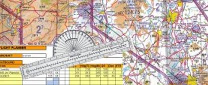 As well as being essential, flight planning is all part of the fun of flying - real world or simulation. Without a plan,
it is easy to get lost, encroach in controlled airspace without permission, fly at incorrect altitudes, and numerous other errors.
Such errors lead to stress, even in the simulator, especially when flying online with the terrifying thought that the sim-world is watching!
So make sure you have a plan, and include contingencies for if things go wrong - weather, aircraft equipment failure, and in the simulator - computer failure.
As well as being essential, flight planning is all part of the fun of flying - real world or simulation. Without a plan,
it is easy to get lost, encroach in controlled airspace without permission, fly at incorrect altitudes, and numerous other errors.
Such errors lead to stress, even in the simulator, especially when flying online with the terrifying thought that the sim-world is watching!
So make sure you have a plan, and include contingencies for if things go wrong - weather, aircraft equipment failure, and in the simulator - computer failure.
Detailed information is available on our Flight Planning page.
Our Air Traffic Control Instructor, Neville Munro, has painstakingly produced data sheets for most UK Airports and Aerodromes. This data is available on the National Air Traffic Service website, but Neville's datasheets are designed to be easier for VFR Simulator pilots to follow, omitting much of the NATS data which isn't important to simulator pilots flying VFR. They can be used during flight with spaces to enter current weather. Most include a diagram of the aerodrome layout, and some include maps showing "no-fly" and noise sensitive zones.
Neville Munro and Neil Ryans have done a similar job with the airfield information for Ireland and other international locations. Where airfield diagrams are not available, Google Earth images provide an alternative view of the airfield layout.
There are places where aircraft cannot go without special clearances. RPDM stands for Restricted, Danger, Prohibited and Military. These areas (or more strictly, volumes, as they have length (north to south) width (east to west) and height (from one altitude, often ground level, to a higher altitude).
Restricted Airspace, Danger Areas and Prohibited airspace are areas where aviation authorities have determined that air traffic must be restricted for safety or security concerns. Restricted airspace and Danger Areas may not be restricted at all times, if the reason for their existence is because they are not always operating (described as "active" in aeronautical jargon), but flight into or within Prohibited Airspace is always prohibited.
Military Aerodrome Traffic Zones (MATZ) are areas where military aircraft operate around military aerodromes. They are shown on charts and civil aircraft may fly within these zones during the hours of operation of the aerodrome with permission from the aerodrome ATC, or outside operating hours, without obtaining permission.
Information regarding upper and lower limits and hours of operation of Restricted Airspace, Danger Areas and Prohibited airspace are published on charts or can be found, for the UK, on the UK Military Aeronautical Information website in the "ENR" section, The following link ENR5.1 opens a pdf document which is updated periodically. MATZ activity is normally the same as the hours of operation of the relevant aerodrome - very often Monday to Friday 08:00 to 17:00.
For Real World pilots, The Skyway Code, published by the Civil Aviation Authority is an essential document. It is also extremely useful for simulator pilots too. The latest version, Version 3 was released in March 2021.
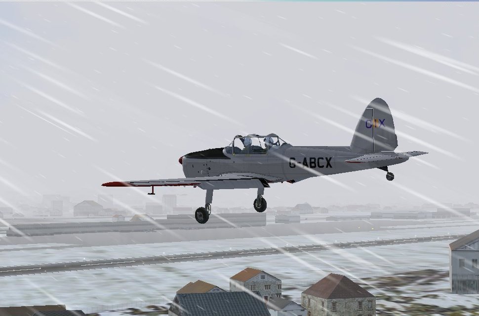
The weather is one of the most important aspects of flying for VFR pilots in small aircraft.
The Online services, VATSIM and IVAO use real world weather, which is provided in the standard International Civil Aviation Organisation (ICAO) coded format. This weather is passed to Flight Simulator as part of the data VATSIM and IVAO transmit, so that all pilots flying in the same area experience the same weather, which adds considerably to the realism of online flying. There is a comprehensive weather tutorial available which is written specifically for Flight Simulator pilots.
The UK Meteorological Office has a wealth of aviation-related weather information. It has its own own weather education website, "Learning about weather" which contains a lot of very useful and interesting information about weather for people of all ages. Members can also register (free) with the Met. Office if they wish to obtain access to the real world General Aviation weather information outside the VATSIM environment. A more general Overview of Met Office Aviation Weather web page may be accessed without registering.